GIS Mapping, Survey
Map Tenure Presentation of Waldaa Community and Key Rangelands Resources Marsabit County
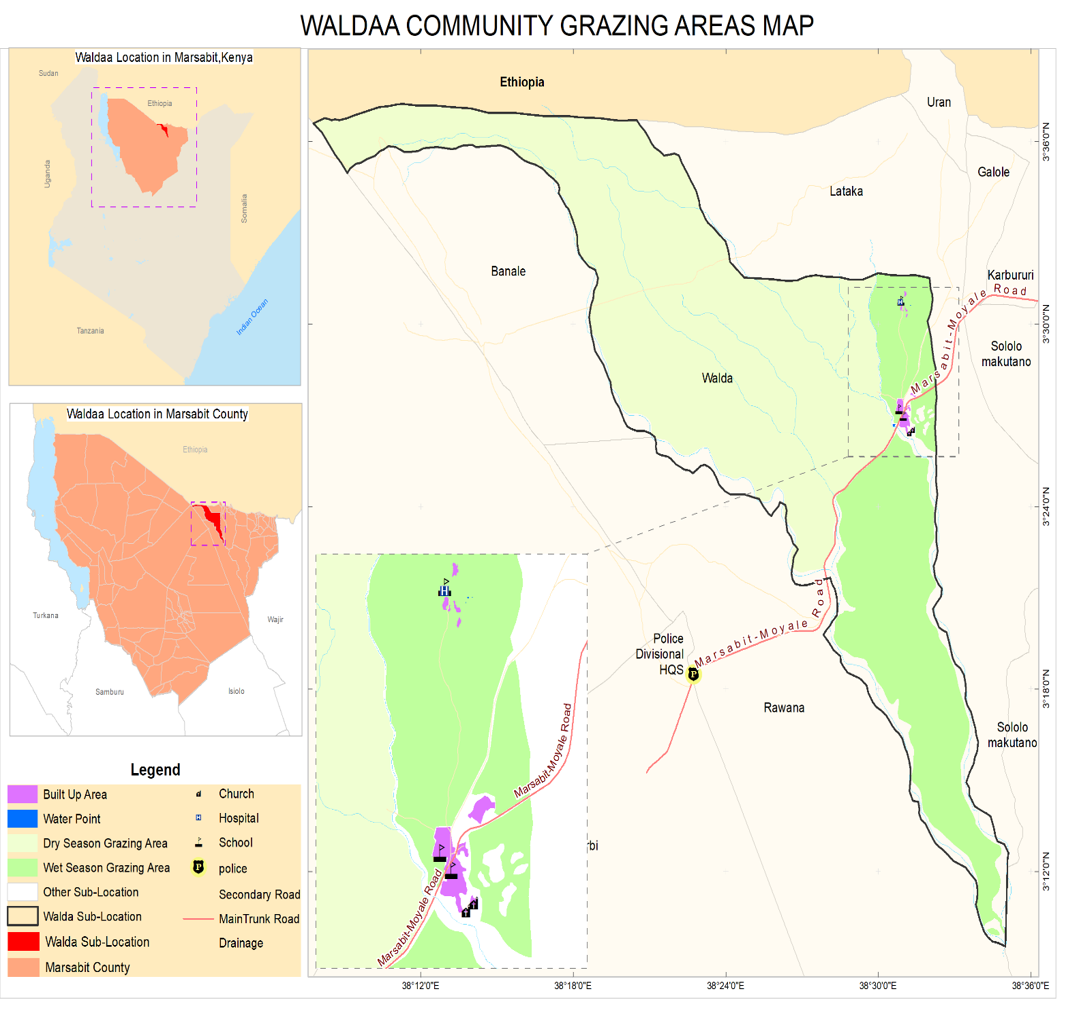
In collaboration with www.reconcile-ea.org and www.ilri.org, Geotechsys Africa engaged in the Map Tenure Presentation of Waldaa Community and Key Rangelands Resources in Marsabit County. Through the use of Participatory Geographic Information Systems (PGIS), our goal was to generate spatial knowledge about pastoralist land tenures and livestock corridors in the Waldaa Community, located in Moyale and Marsabit, Kenya.
The project's primary goal was to conduct a comprehensive assessment of land tenure and rangeland resources in the Waldaa Community, involving:
- Mapping pastoralist land tenures and livestock corridors using Participatory Geographic Information Systems (PGIS).
- Assessing rangeland quality, resource types, and impacts of climate change and conflict through a multi-disciplinary approach.
We engaged community members and stakeholders in mapping and assessment through workshops, interviews, and field surveys, integrating local knowledge into spatial data collection and analysis using PGIS. The project aimed to provide member states with a framework, including catalogues and Atlas, to mitigate climate change, conflict, and inform policy planning. Generating spatial knowledge sought to empower communities, enhance resilience, and promote sustainable land management.